Located in the heart of Australia’s Red Centre, Uluru also known as Ayers Rock is one of the country’s most iconic natural landmarks. For visitors planning a journey to this UNESCO World Heritage Site, understanding the Uluru Ayers Rock map is essential. The area surrounding Uluru is vast, remote, and full of cultural, geological, and ecological significance. A detailed map of Uluru helps travelers navigate walking trails, nearby accommodations, viewpoints, and other natural attractions such as Kata Tjuta. Whether you’re arriving by road or air, having a clear layout of Uluru and its surroundings enhances both safety and enjoyment during your visit.
Understanding the Geography of Uluru
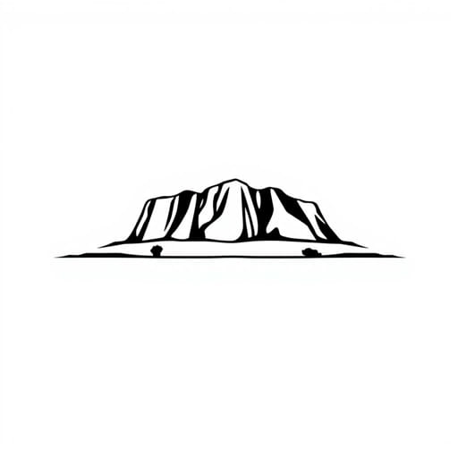
Uluru is situated within Uluru-Kata Tjuta National Park in the southern part of the Northern Territory. The nearest town is Yulara, which serves as the base for most tourists. On a map, Uluru appears as a massive sandstone monolith rising 348 meters above the desert floor and stretching over 9 kilometers around its base.
Key Locations on the Uluru Map
- Uluru Base: The perimeter path where visitors can walk or cycle around the rock
- Uluru Sunset and Sunrise Viewing Areas: Popular lookout spots marked clearly on maps for optimal photography and scenic views
- Mutitjulu Waterhole: A peaceful, culturally significant waterhole on the southeast side of Uluru
- Kuniya Walk and Mala Walk: Short guided or self-guided trails with rich Anangu cultural storytelling
- Yulara (Ayers Rock Resort): The township where accommodations, fuel, and visitor facilities are located
A good map of Uluru typically includes walking trail distances, rest areas, and emergency access points, which are crucial given the extreme desert environment.
Uluru Base Walk Map Highlights
The Uluru Base Walk is one of the most popular experiences for visitors. Spanning approximately 10.6 kilometers, this flat, well-maintained trail encircles the entire rock. A detailed base walk map outlines each section and highlights key stops.
Sections of the Uluru Base Walk
- Mala Walk: Approximately 2 km return, this section includes interpretive signs and rock art sites
- Kantju Gorge: A shaded area with sheer cliffs and a seasonal water pool
- Mutitjulu Waterhole: A culturally significant site with ancestral stories and native flora
- Talinguru Nyakunytjaku: A distant platform offering panoramic views of both Uluru and Kata Tjuta
Many maps also mark shaded benches and water refill stations to help manage the intense desert heat, especially from October through March.
Kata Tjuta (The Olgas) on the Map
About 50 kilometers west of Uluru lies Kata Tjuta, a group of large domed rock formations. Maps of Uluru-Kata Tjuta National Park often include both landmarks since they are part of the same protected area.
Popular Kata Tjuta Map Features
- Valley of the Winds Walk: A moderately challenging 7.4 km loop with map indicators for lookouts and steep sections
- Walpa Gorge Walk: A shorter, easier walk that leads into a narrow passage between two domes
- Sunset and Sunrise Lookouts: Marked on maps for Kata Tjuta, separate from the Uluru viewing areas
These areas are best visited early in the morning or late in the afternoon, both for temperature control and lighting conditions for photography.
Navigation and Safety with the Uluru Map
Despite the clarity of trails and signage, having a physical or digital map of Uluru is highly recommended. Mobile reception is available in some areas but cannot be guaranteed throughout the park.
Navigation Tips
- Use official park maps provided at the Cultural Centre or Ayers Rock Resort
- Download offline maps if using a smartphone
- Observe all signage and stay on marked trails for cultural and safety reasons
Emergency shelters and call points are also indicated on most Uluru trail maps, providing critical support in case of heatstroke or dehydration, which are genuine risks in the desert environment.
Uluru Visitor Centre and Interpretive Maps
Located near the base of Uluru, the Cultural Centre is an essential stop for every visitor. Here, you’ll find detailed interpretive maps, cultural exhibitions, and ranger-guided walk schedules.
What the Cultural Centre Map Includes
- All walking trails and their difficulty levels
- Locations of sacred sites where photography is not allowed
- Facilities such as toilets, shaded areas, and picnic spots
- Information on native plants and animals in the region
The maps provided here are regularly updated and created in consultation with the traditional Anangu owners, ensuring respectful and accurate representation of the land.
Driving Routes and Uluru Road Map
For those driving into the area, understanding the broader road map is just as important as having a trail map. Uluru is accessed primarily via the Lasseter Highway, which connects to the Stuart Highway near Erldunda.
Major Driving Distances
- Alice Springs to Uluru: Approximately 450 km, 5-6 hours by car
- Yulara to Uluru: About 20 km, 15-20 minutes
- Uluru to Kata Tjuta: Around 50 km, 40 minutes
Road maps should include fuel stations, rest areas, and alert travelers to stretches without services. In such remote terrain, proper planning is crucial.
Mapping Cultural Significance
Maps of Uluru are not merely practical tools they also serve to illustrate the deep spiritual and cultural significance of the site. Certain areas are marked as sacred and are restricted from photography or walking.
Respecting Cultural Boundaries
- Avoid entering marked sacred zones
- Do not climb Uluru, in respect to Anangu wishes
- Use interpretive signs to learn about Tjukurpa, the law and stories of the Anangu people
Understanding these boundaries and cultural elements enhances the travel experience and promotes responsible tourism.
A map of Uluru Ayers Rock is much more than a guide it’s a gateway to understanding one of Australia’s most iconic and sacred landscapes. Whether you’re planning hiking trails around the base, driving between viewpoints, or learning about Anangu culture, a well-detailed map ensures a safe, informative, and respectful visit. From walking routes like the Mala and Kuniya Walks to larger journeys toward Kata Tjuta, the landscape offers a wide range of experiences that come alive when guided by accurate and culturally sensitive mapping. For every traveler venturing into the Red Centre, the Uluru Ayers Rock map is a vital companion.